top of page
Open house, council chamber, kitchen table conversation. The same question every time.
A different answer every time.
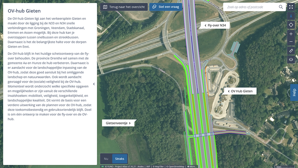
Plan Map
Showing the spatial impact of a plan on its surroundings.
The same question, one source — the answer differs by location, not by conversation.
The Plan Map shows the design, alignment, or spatial plan at scale, in the right place. The question is the same for everyone — where does it go and what does it mean — but the answer differs by location: what is coming, and what it means for those who live, work, or pass through. It is the foundation on which all other maps build.
Consistency
One map as the source, the right answer per location.
Reach
Even those who missed the open house can still find the story.
Calm
Fewer repeated questions, more space for the real conversation.
Works with

Participation Map
Collecting stakeholder feedback in a structured way on the map.
Stakeholder interaction


Visualisation Map
Communicating the visual integration and elaboration of a design.
Communication

Variants Map
Making design variants visually comparable.
Communication
bottom of page